Important
La traduction est le fruit d’un effort communautaire auquel vous pouvez vous joindre. Cette page est actuellement traduite à 85.45%.
3.2. Web Map Service (WMS)
Les normes WMS 1.1.1 et 1.3.0 mises en œuvre dans QGIS Server fournissent une interface HTTP pour demander des images de cartes ou de légendes générées à partir d’un projet QGIS. Une requête WMS typique définit le projet QGIS à utiliser, les couches à rendre ainsi que le format d’image à générer. Un support de base est également disponible pour les Styled Layer Descriptor (SLD).
Spécifications :
Requêtes standard fournies par QGIS Server :
Requête |
Description |
|---|---|
Renvoie des métadonnées XML avec des informations sur le serveur |
|
Renvoie une carte |
|
Récupère les données (géométrie et valeurs) pour un emplacement de pixel |
|
Renvoie les symboles de légende |
|
Renvoie un document XML avec la description du style en SLD |
|
Returns information about WFS and WCS availability respectively for vector and raster layers |
Demandes des fournisseurs fournies par QGIS Server:
Requête |
Description |
|---|---|
Renvoie une mise en page QGIS |
|
Renvoie des informations spécifiques sur QGIS Server |
|
Returns XML metadata about optional extended capabilities |
3.2.1. GetCapabilities
Standard parameters for the GetCapabilities request according to the OGC WMS 1.1.1 and 1.3.0 specifications:
Paramètre |
Requis |
Description |
|---|---|---|
Oui |
Nom du service (WMS) |
|
Oui |
Nom de la requête (GetCapabilities) |
|
Non |
Version du service |
The GetCapabilities request supports as well the following vendor parameters:
Paramètre |
Requis |
Description |
|---|---|---|
Oui |
Fichier du projet QGIS |
Exemple d’URL :
http://localhost/qgisserver?
SERVICE=WMS
&VERSION=1.3.0
&REQUEST=GetCapabilities
3.2.2. GetMap
Paramètres standard pour la requête GetMap selon les spécifications OGC WMS 1.1.1 et 1.3.0 :
Paramètre |
Requis |
Description |
|---|---|---|
Oui |
Nom du service (WMS) |
|
Oui |
Nom de la requete (GetMap) |
|
Oui |
Version du service |
|
Non |
Couches à afficher |
|
Non |
Style des couches |
|
Oui |
Système de coordonnées de référence |
|
Oui |
Emprise de la carte |
|
Oui |
Largeur de l’image en pixels |
|
Oui |
Hauteur de l’image en pixels |
|
Non |
Format de l’image |
|
Non |
Arrière-plan transparent |
|
SLD |
Non |
URL d’un SLD à utiliser pour la symbologie |
SLD_BODY |
Non |
Contenu de SLD (XML) à utiliser pour la symbologie |
In addition to the standard ones, QGIS Server supports redlining, external WMS layers as well as the following extra parameters:
Paramètre |
Requis |
Description |
|---|---|---|
Oui |
Fichier du projet QGIS |
|
Non |
Spécifiez la couleur d’arrière-plan |
|
Non |
Spécifiez la résolution de sortie |
|
Non |
Compression JPEG |
|
Non |
Opacité pour une couche ou un groupe |
|
Non |
Sous-ensemble d’entités |
|
Non |
Mettre en évidence d’entités |
|
FILE_NAME |
Non |
Nom du fichier téléchargé Seulement pour |
Non |
Options du format de fichier spécifié Seulement pour |
|
Non |
Travailler en mode tuile |
Exemple d’URL :
http://localhost/qgisserver?
SERVICE=WMS
&VERSION=1.3.0
&REQUEST=GetMap
&MAP=/home/qgis/projects/world.qgs
&LAYERS=mylayer1,mylayer2,mylayer3
&STYLES=style1,default,style3
&OPACITIES=125,200,125
&CRS=EPSG:4326
&WIDTH=400
&HEIGHT=400
&FORMAT=image/png
&TRANSPARENT=TRUE
&DPI=300
&TILED=TRUE
VERSION
Ce paramètre permet de spécifier la version du service à utiliser. Les valeurs disponibles pour le paramètre VERSION sont:
1.1.11.3.0
Selon le numéro de version, de légères différences sont à prévoir comme expliqué plus loin pour les paramètres suivants:
CRS/SRSBBOX
LAYERS
Ce paramètre permet de spécifier les couches à afficher sur la carte. Les noms doivent être séparés par une virgule.
De plus, QGIS Server a introduit certaines options pour sélectionner des couches en:
the layer id: the project option allowing to select layers by their id is in tab of the dialog. Check the Use layer ids as names checkbox to activate this option.
un nom court
http://localhost/qgisserver?
SERVICE=WMS
&REQUEST=GetMap
&LAYERS=mylayerid1,mylayerid2
&...
STYLES
Ce paramètre peut être utilisé pour spécifier le style d’une couche pour l’étape de rendu. Les styles doivent être séparés par une virgule. Le nom du style par défaut est default.
SRS / CRS
Ce paramètre permet d’indiquer le système de référence spatiale de la sortie de la carte dans WMS 1.1.1 et doit être formé comme EPSG:XXXX. Notez que CRS est également supporté si la version actuelle est 1.1.1.
Pour WMS 1.3.0, le paramètre CRS est préférable mais SRS est également pris en charge.
Notez que si les paramètres CRS et SRS sont indiqués dans la demande, c’est la version actuelle indiquée dans le paramètre VERSION qui est déterminante.
Dans le cas suivant, le paramètre SRS est conservé quel que soit le paramètre VERSION car CRS n’est pas indiqué:
http://localhost/qgisserver?
SERVICE=WMS
&REQUEST=GetMap
&VERSION=1.3.0
&SRS=EPSG:2854
&...
Dans le cas suivant, le paramètre SRS est conservé au lieu de CRS à cause du paramètre VERSION:
http://localhost/qgisserver?
SERVICE=WMS
&REQUEST=GetMap
&VERSION=1.1.1
&CRS=EPSG:4326
&SRS=EPSG:2854
&...
Dans le cas suivant, le paramètre CRS est conservé au lieu de SRS à cause du paramètre VERSION:
http://localhost/qgisserver?
SERVICE=WMS
&REQUEST=GetMap
&VERSION=1.3.0
&CRS=EPSG:4326
&SRS=EPSG:2854
&...
BBOX
Ce paramètre permet de spécifier l’étendue de la carte avec des unités en fonction du SCR actuel. Les coordonnées doivent être séparées par une virgule.
Le paramètre BBOX est formé par min_a,min_b,max_a,max_b mais les axes a et``b`` peuvent varier en fonction du paramètre actuel de VERSION
En WMS 1.1.1, l’ordre des axes est toujours est/nord
En WMS 1.3.0, l’ordre des axes dépend du SCR
Par exemple, dans le cas d’un SCR EPSG:4326 et du protocole WMS en version 1.1.1, a est la longitude (est) et b la latitude (nord), la requête est donc la suivante :
http://localhost/qgisserver?
SERVICE=WMS
&REQUEST=GetMap
&VERSION=1.1.1
&SRS=epsg:4326
&BBOX=-180,-90,180,90
&...
Mais dans le cas du protocole WMS en version 1.3.0, l’ordre des axes définis dans la base EPSG est nord/est donc a est la latitude et b la longitude :
http://localhost/qgisserver?
SERVICE=WMS
&REQUEST=GetMap
&VERSION=1.3.0
&CRS=epsg:4326
&BBOX=-90,-180,90,180
&...
WIDTH
Ce paramètre permet de spécifier la largeur en pixels de l’image de sortie.
HEIGHT
Ce paramètre permet de spécifier la hauteur en pixels de l’image de sortie.
FORMAT
Ce paramètre peut être utilisé pour spécifier le format de l’image de la carte. Les valeurs disponibles sont:
jpgjpegimage/jpegimage/pngimage/png; mode=1bitimage/png; mode=8bitimage/png; mode=16bitimage/webpapplication/dxf: only layers that have read access in the WFS service are exported in the DXF formatExemple d’URL :
http://localhost/qgisserver?
SERVICE=WMS&VERSION=1.3.0
&REQUEST=GetMap
&FORMAT=application/dxf
&LAYERS=Haltungen,Normschacht,Spezialbauwerke
&CRS=EPSG%3A21781
&BBOX=696136.28844801,245797.12108743,696318.91114315,245939.25832905
&WIDTH=1042
&HEIGHT=811
&FORMAT_OPTIONS=MODE:SYMBOLLAYERSYMBOLOGY;SCALE:250
&FILE_NAME=plan.dxf
TRANSPARENT
Ce paramètre booléen peut être utilisé pour spécifier la transparence d’arrière-plan. Les valeurs disponibles sont (non sensibles à la casse):
TRUEFALSE
However, this parameter is ignored if the format of the image indicated with
FORMAT is different from PNG.
BGCOLOR
Ce paramètre permet d’indiquer une couleur de fond pour l’image de la carte. Cependant, il ne peut pas être combiné avec le paramètre TRANSPARENT dans le cas d’images PNG (la transparence est prioritaire). La couleur peut être littérale ou en notation hexadécimale.
Exemple d’URL avec la notation littérale:
http://localhost/qgisserver?
SERVICE=WMS
&REQUEST=GetMap
&VERSION=1.3.0
&BGCOLOR=green
&...
Exemple d’URL avec la notation hexadécimale:
http://localhost/qgisserver?
SERVICE=WMS
&REQUEST=GetMap
&VERSION=1.3.0
&BGCOLOR=0x00FF00
&...
DPI
Ce paramètre peut être utilisé pour spécifier la résolution de sortie demandée.
IMAGE_QUALITY
Ce paramètre n’est utilisé que pour les images JPEG. Par défaut, la compression JPEG est -1.
Vous pouvez modifier la valeur par défaut par projet QGIS dans le menu du menu , vous pouvez le faire en utilisant le paramètre IMAGE_QUALITY.
OPACITIES
Comma separated list of opacity values.
Opacity can be set on layer or group level. Allowed values range from
0 (fully transparent) to 255 (fully opaque).
Exemple d’URL :
http://localhost/qgisserver?
SERVICE=WMS
&REQUEST=GetMap
&VERSION=1.3.0
&WIDTH=400
&HEIGHT=200
&CRS=EPSG:4326
&LAYERS=countries,places
&BBOX=42,-6,52,15
&OPACITIES=255,0

Fig. 3.2 A gauche OPACITIES=255,0 et à droite OPACITIES=255,255
FILTER
Un sous-ensemble de couches peut être sélectionné avec le paramètre FILTER. La syntaxe est fondamentalement la même que pour la chaîne de sous-ensemble QGIS. Cependant, il existe certaines restrictions pour éviter les injections SQL dans les bases de données via QGIS Server. Si une chaîne dangereuse est trouvée dans le paramètre, QGIS Server renverra l’erreur suivante:
<ServiceExceptionReport>
  <ServiceException code="Security">The filter string XXXXXXXXX has been rejected because of security reasons.
  Note: Text strings have to be enclosed in single or double quotes. A space between each word / special character is mandatory.
  Allowed Keywords and special characters are IS,NOT,NULL,AND,OR,IN,=,<,=<,>,>=,!=,',',(,),DMETAPHONE,SOUNDEX.
  Not allowed are semicolons in the filter expression.</ServiceException>
</ServiceExceptionReport>
Exemple d’URL :
http://localhost/qgisserver?
SERVICE=WMS
&REQUEST=GetMap
&VERSION=1.3.0
&WIDTH=400
&HEIGHT=300
&CRS=EPSG:4326
&BBOX=41,-6,52,10
&LAYERS=countries_shapeburst,countries,places
&FILTER=countries_shapeburst,countries:"name" = 'France';places: "name" = 'Paris'
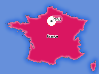
Fig. 3.3 Server response to a GetMap request with FILTER parameter
In this example, the same filter "name" = 'France' is applied to layers
countries and countries_shapeburst, while the filter "name" =
'Paris' is only applied to places.
Note
Il est possible d’effectuer des recherches d’attributs via GetFeatureInfo et d’omettre le paramètre X / Y si un FILTRE est là. QGIS Server renvoie ensuite des informations sur les entités correspondantes et génère un cadre de délimitation combiné dans la sortie XML.
SELECTION
Le paramètre SELECTION peut mettre en évidence les entités d’une ou plusieurs couches. Les entités vectorielles peuvent être sélectionnées en passant des listes séparées par des virgules avec des identifiants d’entités.
http://localhost/qgisserver?
SERVICE=WMS
&REQUEST=GetMap
&LAYERS=mylayer1,mylayer2
&SELECTION=mylayer1:3,6,9;mylayer2:1,5,6
&...
L’image suivante présente la réponse d’une demande GetMap en utilisant l’option SELECTION par ex. http: //myserver.com/...&SELECTION=countries: 171,65.
Comme ces identifiants d’entités correspondent dans l’ensemble de données source à France et Roumanie, ils sont surlignés en jaune.
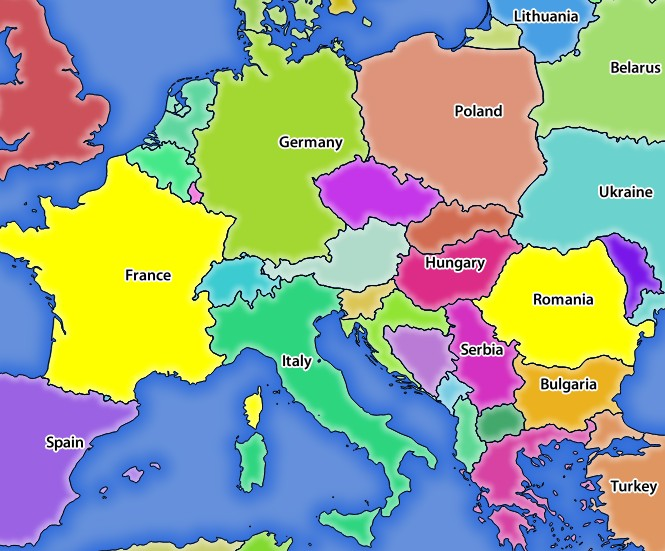
Fig. 3.4 Réponse du serveur à une demande GetMap avec le paramètre SELECTION
FORMAT_OPTIONS
This parameter can be used to specify options for the selected format.
Only for FORMAT=application/dxf in GetMap request.
Takes a list of key:value pairs separated by semicolon:
ÉCHELLE: à utiliser pour les règles de symbologie, les filtres et les styles (pas la mise à l’échelle réelle des données - les données restent à l’échelle d’origine).
MODE: correspond aux options d’exportation proposées dans la boîte de dialogue d’exportation QGIS Desktop DXF. Les valeurs possibles sont
NOSYMBOLOGY,FEATURESYMBOLOGYetSYMBOLLAYERSYMBOLOGY.LAYERATTRIBUTES: specify a field or in case of many layers a comma separated list of fields that contains values for DXF layer names - if not specified, the original QGIS layer names are used.
USE_TITLE_AS_LAYERNAME: si activé, le titre de la couche sera utilisé comme nom de la couche.
CODEC: spécifiez un codec à utiliser pour l’encodage. La valeur par défaut est
ISO-8859-1, vérifiez la boîte de dialogue d’exportation DXF du bureau QGIS pour les valeurs valides.NO_MTEXT : Utilisez TEXT au lieu de MTEXT pour les étiquettes.
FORCE_2D : Force la sortie 2D. Ceci est nécessaire pour la largeur de la polyligne.
TILED
Pour des raisons de performance, QGIS server peut être utilisé en mode « tiled ». Dans ce mode, le client demande plusieurs petites tuiles de taille fixe, et les assemblent pour former la carte entière. Ce faisant, les symboles à la limite ou près de la limite entre deux tuiles peuvent apparaître coupés, car ils ne sont présents que dans une des tuiles.
Mettez le paramètre TILED à TRUE pour indiquer au logiciel QGIS Server de travailler en mode tiled, et d’appliquer le Tile buffer configuré dans le projet QGIS (voir Configurer votre projet).
Lorsque TILED est VRAI et lorsqu’un tampon de tuile différent de zéro est configuré dans le projet QGIS, les entités en dehors de l’étendue de tuile sont dessinées pour éviter les symboles coupés aux limites des tuiles.
TILED est par défaut FALSE.
3.2.3. GetFeatureInfo
Paramètres standard pour la requête GetFeatureInfo selon les spécifications OGC WMS 1.1.1 et 1.3.0 :
Paramètre |
Requis |
Description |
|---|---|---|
Oui |
Nom du service (WMS) |
|
Oui |
nom de la requete (GetFeatureInfo) |
|
Non |
Version du service |
|
Oui |
Couches à interroger |
|
Oui |
Couches de données à afficher (identique à QUERY_LAYERS) |
|
Non |
Style des couches |
|
Oui |
Système de coordonnées de référence |
|
Non |
Emprise de la carte |
|
Oui |
Largeur de l’image en pixels |
|
Oui |
Hauteur de l’image en pixels |
|
Non |
Arrière-plan transparent |
|
Non |
Format de sortie |
|
Non |
Nombre maximum d’entités à renvoyer |
|
Non |
Colonne de pixels du point à interroger |
|
Non |
Identique au paramètre I, mais dans WMS 1.1.1 |
|
Non |
Ligne de pixels du point à interroger |
|
Non |
Identique au paramètre J, mais dans WMS 1.1.1 |
|
WMS_PRECISION |
Non |
La précision (nombre de chiffres) à utiliser lors du retour de la géométrie (voir comment ajouter une géométrie à une entité). La valeur par défaut est « -1 », ce qui signifie que la précision définie dans le projet est utilisée. |
Outre les paramètres standard, QGIS prend en charge les paramètres suivants :
Paramètre |
Requis |
Description |
|---|---|---|
Oui |
Fichier du projet QGIS |
|
Non |
Sous-ensemble d’entités |
|
Non |
Tolérance en pixels pour les couches de points |
|
Non |
Tolérance en pixels pour les couches de lignes |
|
Non |
Tolérance en pixels pour les couches de polygones |
|
Non |
Filtrage géométrique |
|
Non |
Add the feature display name to the output |
|
Non |
Ajouter des conseils de carte à la sortie |
|
Non |
Ajouter une géométrie à la sortie |
Exemple d’URL :
http://localhost/qgisserver?
SERVICE=WMS
&VERSION=1.3.0
&REQUEST=GetMap
&MAP=/home/qgis/projects/world.qgs
&LAYERS=mylayer1,mylayer2,mylayer3
&CRS=EPSG:4326
&WIDTH=400
&HEIGHT=400
&INFO_FORMAT=text/xml
&TRANSPARENT=TRUE
&QUERY_LAYERS=mylayer1
&FEATURE_COUNT=3
&I=250
&J=250
INFO_FORMAT
Ce paramètre peut être utilisé pour spécifier le format du résultat. Les valeurs disponibles sont:
text/xmltext/htmltext/plainapplication/vnd.ogc.gmlapplication/json
QUERY_LAYERS
Ce paramètre spécifie les couches à afficher sur la carte. Les noms sont séparés par une virgule.
De plus, QGIS Server introduit des options pour sélectionner des couches en:
nom court
identifiant de couche
See the LAYERS parameter defined in
GetMap for more information.
FEATURE_COUNT
This parameter specifies the maximum number of features per layer to
return.
For example if QUERY_LAYERS is set to layer1,layer2 and
FEATURE_COUNT is set to 3 then a maximum of 3 features from
layer1 will be returned.
Likewise a maximum of 3 features from layer2 will be returned.
Par défaut, une seule entité par couche est renvoyée.
I
Ce paramètre, défini dans WMS 1.3.0, vous permet de spécifier la colonne de pixels du point de requête.
X
Même paramètre que I, mais défini dans WMS 1.1.1.
J
Ce paramètre, défini dans WMS 1.3.0, vous permet de spécifier la ligne de pixels du point de requête.
Y
Même paramètre que J, mais défini dans WMS 1.1.1.
FI_POINT_TOLERANCE
Ce paramètre spécifie la tolérance en pixels pour les couches de points.
FI_LINE_TOLERANCE
Ce paramètre spécifie la tolérance en pixels pour les couches de lignes.
FI_POLYGON_TOLERANCE
Ce paramètre spécifie la tolérance en pixels pour les couches de polygones.
FILTER_GEOM
Ce paramètre spécifie une géométrie WKT avec laquelle les entités doivent se croiser.
WITH_DISPLAY_NAME
This parameter specifies whether to add feature display name to the output.
Les valeurs disponibles sont (non sensibles à la casse):
TRUEFALSE
WITH_MAPTIP
Ce paramètre spécifie s’il faut ajouter des infobulles à la sortie.
Les valeurs disponibles sont (non sensibles à la casse):
TRUEFALSE
WITH_GEOMETRY
Ce paramètre spécifie s’il faut ajouter des géométries à la sortie. Pour l’utiliser, il vous faut d’abord activer l’option Ajouter la géométrie à la réponse d’une entité dans le projet QGIS. Voir Configurer son projet.
Les valeurs disponibles sont (non sensibles à la casse):
TRUEFALSE
3.2.4. GetLegendGraphic
Paramètres standards pour la requête GetLegendGraphic selon les spécifications OGC WMS 1.1.1 et 1.3.0 :
Paramètre |
Requis |
Description |
|---|---|---|
Oui |
Nom du service (WMS) |
|
Oui |
Nom de la requête (GetLegendGraphic) |
|
Non |
Version du service |
|
Oui |
Couches à afficher |
|
Non |
Style des couches |
|
Non |
Système de coordonnées de référence |
|
Non |
Emprise de la carte |
|
Non |
Largeur de l’image en pixels |
|
Non |
Hauteur de l’image en pixels |
|
Non |
Format de légende |
|
Non |
Arrière-plan transparent |
In addition to the standard ones, QGIS Server supports extra parameters to change the size of the legend elements or the font properties for layer titles and item labels:
Paramètre |
Requis |
Description |
|---|---|---|
Oui |
Fichier du projet QGIS |
|
Non |
Largeur de carte |
|
Non |
Hauteur de carte |
|
Non |
Ajouter le décompte aux entités |
|
Non |
Rule symbol to render |
|
Non |
Item labels rendering |
|
Non |
Space between legend frame and content (mm) |
|
Non |
Vertical space between layers (mm) |
|
Non |
Vertical space between layer title and items (mm) |
|
Non |
Vertical space between symbol and items (mm) |
|
Non |
Horizontal space between symbol and label (mm) |
|
Non |
Width of the symbol preview (mm) |
|
Non |
Height of the symbol preview (mm) |
|
Non |
Layer title rendering |
|
Non |
Layer font family |
|
Non |
Layer title bold rendering |
|
Non |
Layer title font size (pt) |
|
Non |
Layer title italic rendering |
|
Non |
Layer title color |
|
Non |
Item font family |
|
Non |
Item label bold rendering |
|
Non |
Item label font size (pt) |
|
Non |
Item label italic rendering |
|
Non |
Item label color |
|
Non |
Adds the layer groups to JSON output |
BBOX
This parameter can be used to specify the geographical area for which the
legend should be built (its format is described here) but
cannot be combined with the RULE parameter. The SRS/CRS parameter
becomes mandatory when using the BBOX parameter.
Exemple d’URL :
http://localhost/qgisserver?
SERVICE=WMS
&REQUEST=GetLegendGraphic
&LAYERS=countries,airports
&BBOX=43.20,-2.93,49.35,8.32
&CRS=EPSG:4326
Note
When the BBOX parameter is defined, the legend is referred to as a
content based legend.
WIDTH
This parameter is not used by default but becomes mandatory when the RULE
parameter is set. In this case it allows to specify the width in pixels of the
output image.
http://localhost/qgisserver?
SERVICE=WMS
&REQUEST=getlegendgraphic
&LAYER=testlayer%20%C3%A8%C3%A9
&RULE=rule1
&WIDTH=30
&HEIGHT=30
HEIGHT
This parameter is not used by default but becomes mandatory when the RULE
parameter is set. In this case it allows to specify the height in pixels of the
output image.
http://localhost/qgisserver?
SERVICE=WMS
&REQUEST=GetLegendGraphic
&LAYER=testlayer%20%C3%A8%C3%A9
&RULE=rule1
&WIDTH=30
&HEIGHT=30
FORMAT
This parameter may be used to specify the format of legend image. Available values are:
image/jpegimage/pngapplication/json
For JSON, symbols are encoded with Base64 and most other options related to
layout or fonts are not taken into account because the legend must be built on
the client side. The RULE parameter cannot be combined with this format.
URL example with the corresponding JSON output:
http://localhost/qgisserver?
SERVICE=WMS&
REQUEST=GetLegendGraphic&
LAYERS=airports&
FORMAT=application/json
And the corresponding JSON output:
{
  "nodes":[
    {
      "icon":"<base64 icon>",
      "title":"airports",
      "type":"layer"
    }
  ],
  "title":""
}
SRCWIDTH
This parameter may de defined when the RULE parameter is set. In this case,
the SRCWIDTH value is forwarded to the underlying GetMap request as the
WIDTH parameter while the WIDTH parameter of GetLegendGraphic is
used for the image legend size.
SRCHEIGHT
This parameter may de defined when the RULE parameter is set. In this case,
the SRCHEIGHT value is forwarded to the underlying GetMap request as
the HEIGHT parameter while the HEIGHT parameter of GetLegendGraphic
is used for the image legend size.
SHOWFEATURECOUNT
This parameter can be used to activate feature count in the legend. Available values are (not case sensitive):
TRUEFALSE
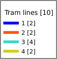
Par exemple:
RULE
This parameter is available on layers with Rule-based rendering and
allows to build a legend with only the named rule symbol. It cannot be combined
with BBOX parameter nor the JSON format. HEIGHT and WIDTH must be
specified.
Exemple d’URL :
http://localhost/qgisserver?
SERVICE=WMS
&REQUEST=GetLegendGraphic
&LAYERS=mylayer,
&RULE=myrulename,
&WIDTH=20,
&HEIGHT=20
RULELABEL
This parameter allows to control the item label rendering. Available values are (not case sensitive):
TRUE: affiche l’étiquette de l’élémentFALSE: cache l’étiquette de l’élémentAUTO: cache l’étiquette de l’élément pour les couches ayant un rendu de type Symbole unique
Exemple d’URL :
http://localhost/qgisserver?
SERVICE=WMS
&REQUEST=GetLegendGraphic
&LAYERS=countries,airports
&BBOX=43.20,-2.93,49.35,8.32
&CRS=EPSG:4326
&TRANSPARENT=TRUE
&RULELABEL=AUTO
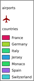
Fig. 3.5 Legend rendering without label for single symbol layers
BOXSPACE
This parameter allows to specify the space between legend frame and content in
millimeters. By default, the space value is 2 mm.
Exemple d’URL :
http://localhost/qgisserver?
SERVICE=WMS
&REQUEST=GetLegendGraphic
&LAYERS=airports
&BBOX=43.20,-2.93,49.35,8.32
&CRS=EPSG:4326
&TRANSPARENT=TRUE
&BOXSPACE=0
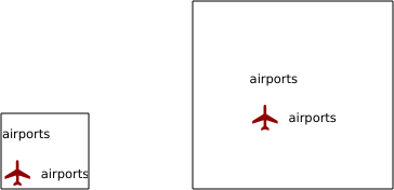
Fig. 3.6 To the left BOXSPACE=0 and to the right BOXSPACE=15
LAYERSPACE
This parameter allows to specify the vertical space between layers in
millimeters. By default, the space value is 3 mm.
Exemple d’URL :
http://localhost/qgisserver?
SERVICE=WMS
&REQUEST=GetLegendGraphic
&LAYERS=airports,places
&BBOX=43.20,-2.93,49.35,8.32
&CRS=EPSG:4326
&TRANSPARENT=TRUE
&LAYERSPACE=0
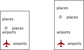
Fig. 3.7 To the left LAYERSPACE=0 and to the right LAYERSPACE=10
LAYERTITLESPACE
This parameter allows to specify the vertical space between layer title and
items following in millimeters. By default the space value is 3 mm.
Exemple d’URL :
http://localhost/qgisserver?
SERVICE=WMS
&REQUEST=GetLegendGraphic
&LAYERS=airports,places
&BBOX=43.20,-2.93,49.35,8.32
&CRS=EPSG:4326
&TRANSPARENT=TRUE
&LAYERTITLESPACE=0
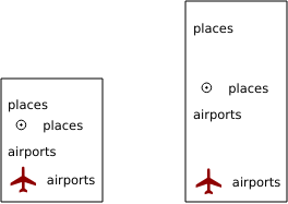
Fig. 3.8 To the left LAYERTITLESPACE=0 and to the right LAYERTITLESPACE=10
SYMBOLSPACE
This parameter allows to specify the vertical space between symbol and item
following in millimeters. By default the space value is 2 mm.
Exemple d’URL :
http://localhost/qgisserver?
SERVICE=WMS
&REQUEST=GetLegendGraphic
&LAYERS=countries
&BBOX=43.20,-2.93,49.35,8.32
&CRS=EPSG:4326
&TRANSPARENT=TRUE
&SYMBOLSPACE=0
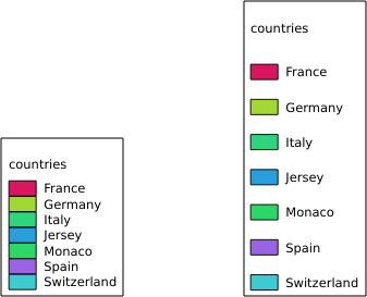
Fig. 3.9 To the left SYMBOLSPACE=0 and to the right SYMBOLSPACE=5
ICONLABELSPACE
This parameter allows to specify the horizontal space between symbol and label
text in millimeters. By default the space value is 2 mm.
Exemple d’URL :
http://localhost/qgisserver?
SERVICE=WMS
&REQUEST=getlegendgraphic
&LAYERS=countries,
&BBOX=43.20,-2.93,49.35,8.32
&CRS=EPSG:4326
&TRANSPARENT=TRUE
&ICONLABELSPACE=0
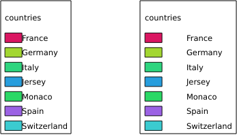
Fig. 3.10 To the left ICONLABELSPACE=0 and to the right ICONLABELSPACE=10
SYMBOLWIDTH
This parameter allows to specify the width of the symbol preview in
millimeters. By default the width value is 7 mm.
Exemple d’URL :
http://localhost/qgisserver?
SERVICE=WMS
&REQUEST=GetLegendGraphic
&LAYERS=countries,
&BBOX=43.20,-2.93,49.35,8.32
&CRS=EPSG:4326
&TRANSPARENT=TRUE
&SYMBOLWIDTH=2
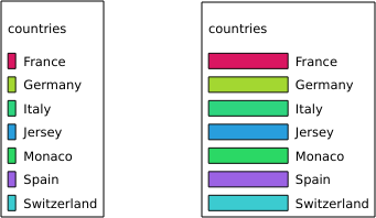
Fig. 3.11 To the left SYMBOLWIDTH=2 and to the right SYMBOLWIDTH=20
SYMBOLHEIGHT
This parameter allows to specify the height of the symbol preview in
millimeters. By default the height value is 4 mm.
Exemple d’URL :
http://localhost/qgisserver?
SERVICE=WMS
&REQUEST=GetLegendGraphic
&LAYERS=countries,
&BBOX=43.20,-2.93,49.35,8.32
&CRS=EPSG:4326
&TRANSPARENT=TRUE
&SYMBOLHEIGHT=2
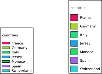
Fig. 3.12 To the left SYMBOLHEIGHT=2 and to the right SYMBOLHEIGHT=6
LAYERTITLE
This parameter specifies whether to render layer title.
Les valeurs disponibles sont (non sensibles à la casse):
TRUE(valeur par défaut)FALSE
LAYERFONTFAMILY
This parameter specifies the font family to use for rendering layer title.
http://localhost/qgisserver?
SERVICE=WMS
&REQUEST=GetLegendGraphic
&LAYERS=countries
&LAYERFONTFAMILY=monospace
LAYERFONTBOLD
This parameter specifies whether the layer title is rendered in bold. Available values are (not case sensitive):
TRUEFALSE
Exemple d’URL :
http://localhost/qgisserver?
SERVICE=WMS
&REQUEST=GetLegendGraphic
&LAYERS=airports,places
&BBOX=43.20,-2.93,49.35,8.32
&CRS=EPSG:4326
&TRANSPARENT=TRUE
&LAYERFONTBOLD=TRUE

Fig. 3.13 Légende avec LAYERFONTBOLD=TRUE
LAYERFONTSIZE
This parameter specifies the font size for rendering layer title in point.
Exemple d’URL :
http://localhost/qgisserver?
SERVICE=WMS
&REQUEST=GetLegendGraphic
&LAYERS=airports,places
&BBOX=43.20,-2.93,49.35,8.32
&CRS=EPSG:4326
&TRANSPARENT=TRUE
&LAYERFONTSIZE=20

Fig. 3.14 Légende avec LAYERFONTSIZE=20
LAYERFONTITALIC
This parameter specifies whether the layer title is rendered in italic. Available values are (not case sensitive):
TRUEFALSE
Exemple d’URL :
http://localhost/qgisserver?
SERVICE=WMS
&REQUEST=GetLegendGraphic
&LAYERS=airports,places
&BBOX=43.20,-2.93,49.35,8.32
&CRS=EPSG:4326
&TRANSPARENT=TRUE
&LAYERFONTITALIC=TRUE

Fig. 3.15 Légende avec LAYERFONTITALIC=TRUE
LAYERFONTCOLOR
This parameter specifies the layer title color. The color may be literal
(red, green, ..) or in hexadecimal notation (0xFF0000,
0x00FF00, …).
Exemple d’URL :
http://localhost/qgisserver?
SERVICE=WMS
&REQUEST=GetLegendGraphic
&LAYERS=airports,places
&BBOX=43.20,-2.93,49.35,8.32
&CRS=EPSG:4326
&TRANSPARENT=TRUE
&LAYERFONTCOLOR=0x5f9930

Fig. 3.16 Légende avec LAYERFONTCOLOR=0x5f9930
ITEMFONTFAMILY
This parameter specifies the font family to use for rendering item label.
http://localhost/qgisserver?
SERVICE=WMS
&REQUEST=GetLegendGraphic
&LAYERS=countries
&ITEMFONTFAMILY=monospace
ITEMFONTBOLD
This parameter specifies whether the item label is rendered in bold. Available values are (not case sensitive):
TRUEFALSE
Exemple d’URL :
http://localhost/qgisserver?
SERVICE=WMS
&REQUEST=GetLegendGraphic
&LAYERS=airports,places
&BBOX=43.20,-2.93,49.35,8.32
&CRS=EPSG:4326
&TRANSPARENT=TRUE
&ITEMFONTBOLD=TRUE

Fig. 3.17 Légende avec ITEMFONTBOLD=TRUE
ITEMFONTSIZE
This parameter specifies the font size for rendering layer title in point.
Exemple d’URL :
http://localhost/qgisserver?
SERVICE=WMS
&REQUEST=GetLegendGraphic
&LAYERS=airports,places
&BBOX=43.20,-2.93,49.35,8.32
&CRS=EPSG:4326
&TRANSPARENT=TRUE
&ITEMFONTSIZE=20

Fig. 3.18 Légende avec ITEMFONTSIZE=30
ITEMFONTITALIC
This parameter specifies whether the item label is rendered in italic. Available values are (not case sensitive):
TRUEFALSE
Exemple d’URL :
http://localhost/qgisserver?
SERVICE=WMS
&REQUEST=GetLegendGraphic
&LAYERS=airports,places
&BBOX=43.20,-2.93,49.35,8.32
&CRS=EPSG:4326
&TRANSPARENT=TRUE
&ITEMFONTITALIC=TRUE

Fig. 3.19 Légende avec ITEMFONTITALIC=TRUE
ITEMFONTCOLOR
This parameter specifies the item label color. The color may be literal
(red, green, ..) or in hexadecimal notation (0xFF0000,
0x00FF00, …).
Exemple d’URL :
http://localhost/qgisserver?
SERVICE=WMS
&REQUEST=GetLegendGraphic
&LAYERS=airports,places
&BBOX=43.20,-2.93,49.35,8.32
&CRS=EPSG:4326
&TRANSPARENT=TRUE
&ITEMFONTCOLOR=0x5f9930

Fig. 3.20 Légende avec ITEMFONTCOLOR=0x5f9930
ADDLAYERGROUPS
This parameter specifies if the JSON output will also display the names of the layers groups (and subgroups) in the legend entry. Possible values are:
TRUE: display the groups labelsFALSE(default): hide the groups labels
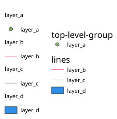
Fig. 3.21 Legend without (left) and with (right) layer groups labels display
The corresponding JSON output showing groups name would look like:
{ "nodes":
  [{ "nodes":
     [{ "icon":"iVBORw0KGgoAAAANSUhEUgAAABQAAAAUCAYAAACNiR0NAAAACXBIWXMAABYlAAAWJQFJUiTwAAAAUklEQVQ4jWNgGAXDHzASUqCsrPwfmX/37l28evBKKisr/0+a7IMiNi93C15DcUpgM4wYQ5nwuZAcMIQNvHv3LuO83C0kG0hysoFZRrJNo2AYAQC87BpkGQj1fwAAAABJRU5ErkJggg==",
        "title":"layer_a", "type":"layer"
     },
     { "nodes":
       [{ "icon":"iVBORw0KGgoAAAANSUhEUgAAABMAAAAUCAYAAABvVQZ0AAAACXBIWXMAABYlAAAWJQFJUiTwAAAAHUlEQVQ4jWNgGAWjYCQDxh887r8G2hGjYBQMGAAA1x0CR0FzIkYAAAAASUVORK5CYII=",
          "title":"layer_b", "type":"layer"
        },
        { "icon":"iVBORw0KGgoAAAANSUhEUgAAABMAAAAUCAYAAABvVQZ0AAAACXBIWXMAABYlAAAWJQFJUiTwAAAAHUlEQVQ4jWNgGAWjYCQDxtmzZ/8aaEeMglEwYAAAaIoCzTtn5XoAAAAASUVORK5CYII=",
          "title":"layer_c", "type":"layer"
       }],
       "title":"lines", "type":"group"
     },
     { "icon":"iVBORw0KGgoAAAANSUhEUgAAABMAAAATCAYAAAByUDbMAAAACXBIWXMAABYlAAAWJQFJUiTwAAAAKklEQVQ4jWNUVlX/z0AlwMLAwMDAnXmQKoYxUcWUUcNGDRs1bNSwYWYYACXDAsvQaTuVAAAAAElFTkSuQmCC",
       "title":"layer_d", "type":"layer"
     }],
     "title":"top-level-group", "type":"group"
  }],
  "title":""
}
3.2.5. GetStyle(s)
Standard parameters for the GetStyle (or GetStyles) request according to the OGC WMS 1.1.1 specifications:
Paramètre |
Requis |
Description |
|---|---|---|
Oui |
Nom du service (WMS) |
|
Oui |
Nom de la requête (GetStyle ou GetStyles) |
|
Oui |
Couches à interroger |
The GetStyle request supports as well the following vendor parameters:
Paramètre |
Requis |
Description |
|---|---|---|
Oui |
Fichier du projet QGIS |
Exemple d’URL :
http://localhost/qgisserver?
SERVICE=WMS
&REQUEST=GetStyles
&LAYERS=mylayer1,mylayer2
3.2.6. DescribeLayer
Standard parameters for the DescribeLayer request according to the OGC WMS 1.1.1 and 1.3.0 specifications:
Paramètre |
Requis |
Description |
|---|---|---|
Oui |
Nom du service (WMS) |
|
Oui |
Nom de la requête (DescribeLayer) |
|
Oui |
Couches à décrire |
|
Oui |
Version de SLD |
The DescribeLayer request supports as well the following vendor parameters:
Paramètre |
Requis |
Description |
|---|---|---|
Oui |
Fichier du projet QGIS |
Exemple d’URL :
http://localhost/qgisserver?
SERVICE=WMS
&REQUEST=DescribeLayer
&SLD_VERSION=1.1.0
&LAYERS=mylayer1
Le document XML ressemble à :
<DescribeLayerResponse xmlns="http://www.opengis.net/sld" xmlns:xsi="http://www.w3.org/2001/XMLSchema-instance" xmlns:ows="http://www.opengis.net/ows" xmlns:xlink="http://www.w3.org/1999/xlink" xmlns:se="http://www.opengis.net/se" xsi:schemaLocation="http://www.opengis.net/sld http://schemas.opengis.net/sld/1.1.0/DescribeLayer.xsd">
    <Version>1.1.0</Version>
    <LayerDescription>
        <owsType>wfs</owsType>
        <se:OnlineResource xlink:href="http://localhost/qgisserver" xlink:type="simple"/>
        <TypeName>
            <se:FeatureTypeName>my_vector_layer</se:FeatureTypeName>
        </TypeName>
    </LayerDescription>
    <LayerDescription>
        <owsType>wcs</owsType>
        <se:OnlineResource xlink:href="http://localhost/qgisserver" xlink:type="simple"/>
        <TypeName>
            <se:FeatureTypeName>my_raster_layer</se:FeatureTypeName>
        </TypeName>
    </LayerDescription>
</DescribeLayerResponse>
SLD_VERSION
This parameter allows to specify the version of SLD. Only the value 1.1.0
is available.
3.2.7. GetPrint
QGIS Server a la capacité de créer une sortie de mise en page d’impression au format pdf ou pixel. Les fenêtres de mise en page d’impression dans le projet publié sont utilisées comme modèles. Dans la demande GetPrint, le client a la possibilité de spécifier les paramètres des mises en page et des étiquettes contenues.
The GetPrint request supports redlining, external WMS layers as well as the following parameters:
Paramètre |
Requis |
Description |
|---|---|---|
Oui |
Fichier du projet QGIS |
|
Oui |
Nom du service (WMS) |
|
Oui |
Nom de la requête (GetPrint) |
|
Non |
Version du service |
|
Non |
Couches à afficher |
|
Oui |
Modèle de mise en page à utiliser |
|
Oui |
Système de coordonnées de référence |
|
Non |
Format de sortie |
|
Non |
Options du format de fichier spécifié Seulement pour |
|
Non |
Entité atlas |
|
Non |
Style des couches |
|
Non |
Arrière-plan transparent |
|
Non |
Opacité pour une couche ou un groupe |
|
Non |
Mettre en évidence d’entités |
|
Non |
Étendue de la carte “X” |
|
Non |
Couches de la carte “X” |
|
Non |
Style de couche de la carte “X” |
|
Non |
Échelle des couches de la carte “X” |
|
Non |
Rotation de la carte “X” |
|
Non |
Intervalle de grille sur l’axe x de la carte “X” |
|
Non |
Intervalle de grille sur l’axe y de la carte “X” |
Exemple d’URL :
http://localhost/qgisserver?
SERVICE=WMS
&VERSION=1.3.0
&REQUEST=GetPrint
&MAP=/home/qgis/projects/world.qgs
&CRS=EPSG:4326
&FORMAT=png
&TEMPLATE=Layout%201
&map0:EXTENT=-180,-90,180,90
&map0:LAYERS=mylayer1,mylayer2,mylayer3
&map0:OPACITIES=125,200,125
&map0:ROTATION=45
Notez que le modèle de mise en page peut contenir plusieurs cartes. De cette façon, si vous souhaitez configurer une carte spécifique, vous devez utiliser les paramètres mapX: où X est un nombre positif que vous pouvez récupérer grâce à la requête GetProjectSettings.
Par exemple:
<WMS_Capabilities>
...
<ComposerTemplates xsi:type="wms:_ExtendedCapabilities">
<ComposerTemplate width="297" height="210" name="Druckzusammenstellung 1">
<ComposerMap width="171" height="133" name="map0"/>
<ComposerMap width="49" height="46" name="map1"/></ComposerTemplate>
</ComposerTemplates>
...
</WMS_Capabilities>
TEMPLATE
Ce paramètre peut être utilisé pour spécifier le nom d’un modèle de mise en page à utiliser pour l’impression.
FORMAT
Ce paramètre spécifie le format de l’image de la carte. Les valeurs disponibles sont:
png(valeur par défaut)image/pngjpgjpegimage/jpegsvgimage/svgimage/svg+xmlpdfapplication/pdf
Si le paramètre FORMAT est différent de l’une de ces valeurs, une exception est renvoyée.
FORMAT_OPTIONS
This parameter can be used to specify options for the selected format.
Only for FORMAT=application/pdf in GetPrint requests.
Takes a list of key:value pairs separated by semicolon:
RASTERIZE_WHOLE_IMAGE: whether the whole pdf should be exported as an image. Default: false.FORCE_VECTOR_OUTPUT: whether pdf should be exported as vector. Default: false.APPEND_GEOREFERENCE: whether georeference info shall be added to the pdf. Default: true.EXPORT_METADATA: whether metadata shall be added to the pdf. Default: true.TEXT_RENDER_FORMAT: sets the text render format for pdf export. It can beAlwaysOutlines(default) orAlwaysText.SIMPLIFY_GEOMETRY: whether features geometries shall be simplified. Default: true.WRITE_GEO_PDF: whether a Geospatial PDF shall be exported. Default: false.USE_ISO_32000_EXTENSION_FORMAT_GEOREFERENCING: whether Iso32000 georeferencing shall be used. Default: false.USE_OGC_BEST_PRACTICE_FORMAT_GEOREFERENCING: whether OGC best practice georeferencing shall be used. Default: false.EXPORT_THEMES: a comma separated list of map themes to use for a Geospatial PDF exportPREDEFINED_MAP_SCALES: a comma separated list of map scales to render the mapLOSSLESS_IMAGE_COMPRESSION: whether images embedded in pdf must be compressed using a lossless algorithm. Default: false.DISABLE_TILED_RASTER_RENDERING: whether rasters shall be untiled in the pdf. Default: false.
Exemple d’URL :
http://localhost/qgisserver?
SERVICE=WMS
&VERSION=1.3.0
&REQUEST=GetPrint
&MAP=/home/qgis/projects/world.qgs
&CRS=EPSG:4326
&FORMAT=pdf
&TEMPLATE=Layout%201
&FORMAT_OPTIONS=FORCE_VECTOR_OUTPUT:TRUE;TEXT_RENDER_FORMAT:AlwaysOutlines;PREDEFINED_MAP_SCALES:250
ATLAS_PK
Ce paramètre permet d’activer le rendu Atlas en indiquant quelles entités nous voulons imprimer. Afin de récupérer un atlas avec toutes les fonctionnalités, le symbole * peut être utilisé (selon le nombre maximum d entités autorisé dans la configuration du projet).
Lorsque FORMAT est pdf, un seul document PDF combinant les pages d’entités est renvoyé. Pour tous les autres formats, une seule page est renvoyée.
mapX:EXTENT
Ce paramètre spécifie l’étendue d’un élément de mise en page sous la forme xmin, ymin, xmax, ymax.
mapX:ROTATION
Ce paramètre spécifie la rotation de la carte en degrés.
mapX:GRID_INTERVAL_X
Ce paramètre spécifie la densité du quadrillage dans la direction X.
mapX:GRID_INTERVAL_Y
Ce paramètre spécifie la densité de la ligne de grille dans la direction Y.
mapX:SCALE
Ce paramètre spécifie l’échelle de la carte pour un élément de la mise en page. Ceci est utile pour assurer une visibilité basée sur l’échelle des couches et des étiquettes même si le client et le serveur peuvent avoir des algorithmes différents pour calculer le dénominateur d’échelle.
mapX:LAYERS
This parameter specifies the layers for a layout map item. See GetMap Layers for more information on this parameter.
mapX:STYLES
This parameter specifies the layers” styles defined in a specific layout map item. See GetMap Styles for more information on this parameter.
3.2.8. GetProjectSettings
This request type works similar to GetCapabilities, but it is more specific to QGIS Server and allows a client to read additional information which are not available in the GetCapabilities output:
visibilité initiale des couches
information sur les attributs des vecteurs et leur type d’éditeur
information sur l’ordre des couches et de leur rendu
liste des couches publiées en WFS
montrer si un groupe dans l’arbre des couches est mutualy exclusive
The GetProjectSettings request supports the following parameters:
Paramètre |
Requis |
Description |
|---|---|---|
Oui |
Fichier du projet QGIS |
|
Oui |
Nom du service (WMS) |
|
Oui |
Nom de la requête (GetProjectSettings) |
3.2.9. GetSchemaExtension
The GetSchemaExtension request allows to retrieve optional extended capabilities and operations of the WMS service such as implemented by QGIS Server.
Paramètre |
Requis |
Description |
|---|---|---|
Oui |
Fichier du projet QGIS |
|
Oui |
Nom du service (WMS) |
|
Oui |
Nom de la requête (GetSchemaExtension) |
Exemple d’URL :
http://localhost/qgisserver?
SERVICE=WMS
&REQUEST=GetSchemaExtension
Le document XML ressemble à :
<schema xmlns="http://www.w3.org/2001/XMLSchema" xmlns:wms="http://www.opengis.net/wms" xmlns:qgs="http://www.qgis.org/wms" targetNamespace="http://www.qgis.org/wms" elementFormDefault="qualified" version="1.0.0">
    <import namespace="http://www.opengis.net/wms" schemaLocation="http://schemas.opengis.net/wms/1.3.0/capabilities_1_3_0.xsd"/>
    <element name="GetPrint" type="wms:OperationType" substitutionGroup="wms:_ExtendedOperation"/>
    <element name="GetStyles" type="wms:OperationType" substitutionGroup="wms:_ExtendedOperation"/>
</schema>
3.2.10. Couches WMS externes
QGIS Server allows including layers from external WMS servers in WMS GetMap and WMS GetPrint requests. This is especially useful if a web client uses an external background layer in the web map. For performance reasons, such layers should be directly requested by the web client (not cascaded via QGIS server). For printing however, these layers should be cascaded via QGIS server in order to appear in the printed map.
External layers can be added to the LAYERS parameter as EXTERNAL_WMS:<layername>. The parameters for the external WMS layers (e.g. url, format, dpiMode, crs, layers, styles) can later be given as service parameters <layername>:<parameter>. In a GetMap request, this might look like this:
http://localhost/qgisserver?
SERVICE=WMS
&REQUEST=GetMap
&LAYERS=EXTERNAL_WMS:basemap,layer1,layer2
&OPACITIES=100,200,255
&STYLES=,,
&basemap:url=http://externalserver.com/wms.fcgi
&basemap:format=image/jpeg
&basemap:dpiMode=7
&basemap:crs=EPSG:2056
&basemap:layers=orthofoto
&basemap:styles=default
Similarly, external layers can be used in GetPrint requests:
http://localhost/qgisserver?
SERVICE=WMS
&REQUEST=GetPrint
&TEMPLATE=A4
&map0:layers=EXTERNAL_WMS:basemap,layer1,layer2
&map0:EXTENT=<minx,miny,maxx,maxy>
&OPACITIES=100,200,255
&basemap:url=http://externalserver.com/wms.fcgi
&basemap:format=image/jpeg
&basemap:dpiMode=7
&basemap:crs=EPSG:2056
&basemap:layers=orthofoto
&basemap:styles=default
3.2.11. Redlining
This feature is available and can be used with GetMap and GetPrint requests.
La fonction de mise en évidence peut être utilisée pour transmettre des géométries et des étiquettes dans la demande qui se chevauchent par le serveur sur l’image retournée standard (carte). Cela permet à l’utilisateur de mettre l’accent ou peut-être d’ajouter des commentaires (étiquettes) à certaines zones, emplacements, etc. qui ne figurent pas sur la carte standard.
The GetMap request is in the format:
http://localhost/qgisserver?
SERVICE=WMS
&VERSION=1.3.0
&REQUEST=GetMap
&HIGHLIGHT_GEOM=POLYGON((590000 5647000, 590000 6110620, 2500000 6110620, 2500000 5647000, 590000 5647000))
&HIGHLIGHT_SYMBOL=<StyledLayerDescriptor><UserStyle><Name>Highlight</Name><FeatureTypeStyle><Rule><Name>Symbol</Name><LineSymbolizer><Stroke><SvgParameter name="stroke">%23ea1173</SvgParameter><SvgParameter name="stroke-opacity">1</SvgParameter><SvgParameter name="stroke-width">1.6</SvgParameter></Stroke></LineSymbolizer></Rule></FeatureTypeStyle></UserStyle></StyledLayerDescriptor>
&HIGHLIGHT_LABELSTRING=Write label here
&HIGHLIGHT_LABELSIZE=16
&HIGHLIGHT_LABELCOLOR=%23000000
&HIGHLIGHT_LABELBUFFERCOLOR=%23FFFFFF
&HIGHLIGHT_LABELBUFFERSIZE=1.5
The GetPrint equivalent is in the format (note that
mapX: parameter is added to tell which map has redlining):
http://localhost/qgisserver?
SERVICE=WMS
&VERSION=1.3.0
&REQUEST=GetPrint
&map0:HIGHLIGHT_GEOM=POLYGON((590000 5647000, 590000 6110620, 2500000 6110620, 2500000 5647000, 590000 5647000))
&map0:HIGHLIGHT_SYMBOL=<StyledLayerDescriptor><UserStyle><Name>Highlight</Name><FeatureTypeStyle><Rule><Name>Symbol</Name><LineSymbolizer><Stroke><SvgParameter name="stroke">%23ea1173</SvgParameter><SvgParameter name="stroke-opacity">1</SvgParameter><SvgParameter name="stroke-width">1.6</SvgParameter></Stroke></LineSymbolizer></Rule></FeatureTypeStyle></UserStyle></StyledLayerDescriptor>
&map0:HIGHLIGHT_LABELSTRING=Write label here
&map0:HIGHLIGHT_LABELSIZE=16
&map0:HIGHLIGHT_LABELCOLOR=%23000000
&map0:HIGHLIGHT_LABELBUFFERCOLOR=%23FFFFFF
&map0:HIGHLIGHT_LABELBUFFERSIZE=1.5
Voici l’image produite par la demande ci-dessus dans laquelle un polygone et une étiquette sont dessinés au-dessus de la carte normale:
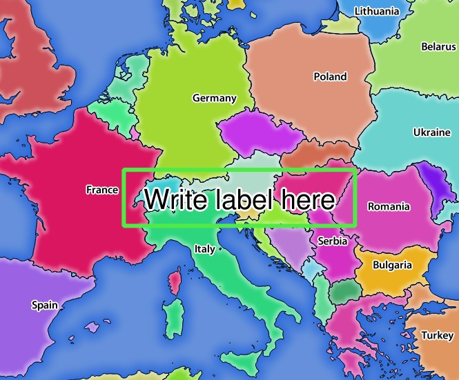
Fig. 3.22 Réponse du serveur à une demande GetMap avec paramètres de mise en évidence
You can see there are several parameters in this request to control the redlining feature. The full list includes:
HIGHLIGHT_GEOM: Vous pouvez ajouter POINT, MULTILINESTRING, POLYGON etc. Il prend en charge les géométries en plusieurs parties. Voici un exemple:
HIGHLIGHT_GEOM = MULTILINESTRING((0 0, 0 1, 1 1)). Les coordonnées doivent être dans le CRS de la demande GetMap / GetPrint.HIGHLIGHT_LABELBUFFERCOLOR: ce paramètre contrôle la couleur du tampon d’étiquette.
HIGHLIGHT_LABELBUFFERSIZE: ce paramètre contrôle la taille du tampon d’étiquette.
HIGHLIGHT_LABELCOLOR: ce paramètre contrôle la couleur de l’étiquette.
HIGHLIGHT_LABEL_DISTANCE: controls the distance between feature (e.g. point or line) and the label in mm
HIGHLIGHT_LABELFONT : Ce paramètre contrôle la police de l’étiquette (par exemple Arial)
HIGHLIGHT_LABEL_HORIZONTAL_ALIGNMENT: places the label horizontally on a point using the specified alignment (e.g. “left”, “center”, “right”)
HIGHLIGHT_LABEL_ROTATION: controls the label rotation in degrees
HIGHLIGHT_LABELSIZE: ce paramètre contrôle la taille de l’étiquette.
HIGHLIGHT_LABELSTRING: vous pouvez transmettre votre texte d’étiquetage à ce paramètre.
HIGHLIGHT_LABEL_VERTICAL_ALIGNMENT: places the label vertically on a point using the specified alignment (e.g. “top”, “half”, “bottom”)
HIGHLIGHT_SYMBOL: cela contrôle la manière dont la géométrie est définie et vous pouvez modifier la largeur, la couleur et l’opacité du trait.